If your students like exploring the infinity of space, introduce them to these three programmes. All open source and free for everyone to install.
 |
| Stellarium |
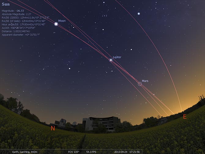
1.
Stellarium... "is a free open source planetarium for your computer. It shows a realistic sky in 3D, just like what you see with the naked eye, binoculars or a telescope.It is being used in planetarium projectors. Just set your coordinates and go." Available for Windows/Mac/Linux.
 |
| Celestia |
2.
Celestia. The free space simulation that lets you explore our universe in three dimensions. Unlike most planetarium software, Celestia doesn't confine you to the surface of the Earth. You can travel throughout the solar system, to any of over 100,000 stars, or even beyond the galaxy. Available for Windows/Mac/Linux.
3.
Virtual Moon Atlas. "Software for Moon observation and survey. Let you visualize the real Moon aspect at every time. Also help to study any lunar formations using feature database and pictures library" Available for Windows/Mac/Linux.
To infinity and beyond.


